![]()
![]()
|
|
|
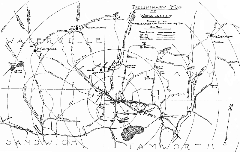
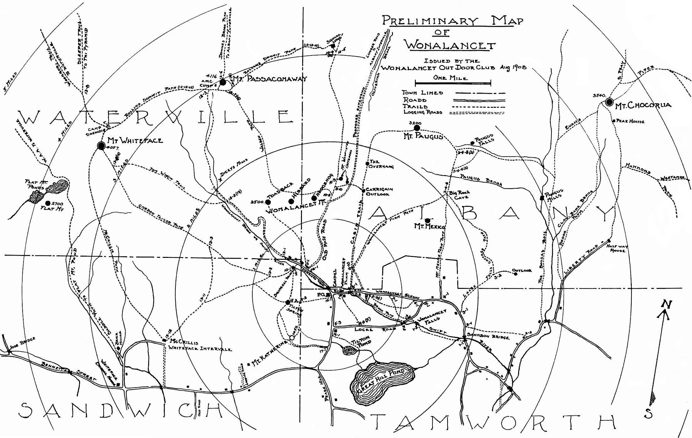
The WODC has published a number of maps over its 100 year history. The older maps are gradually being scanned and are available for download as listed below. Please do not rely on these maps for navigation, as they contain numerous inaccuracies. (Please order a current WODC map instead!) 1901 "Sketch Map of the Sandwich Range" PDF Image 1901 "Sketch Map of Wonalancet" PDF Image 1908 "Preliminary Map Of Wonalancet"
Circa 1915 map by "A.E.B" PDF Image WODC 1991 "Trail Map and Guide to the Sandwich Range Wilderness" WODC 2007 "Trail Map & Guide to the Sandwich Range" PDF Image (1.6MB) Please do not rely on these maps for navigation. Use the current WODC map instead! Also available for purchase: Trail Maps of the Wonalancet Out Door Club: A History, 1901-1995, by John R. Boettiger. A booklet prepared to accompany a 2001 exhibit of 95 years of mapmaking by WODC. Text, origins of the Club during the 1890s, reproductions of several of the historical maps, illustrative pages from WODC’s 1901 Guide to Wonalancet and the Sandwich Range. Please use the order form to purchase your copy.
|
|
Contact Us This page was last modified on 05/05/2026 . |